
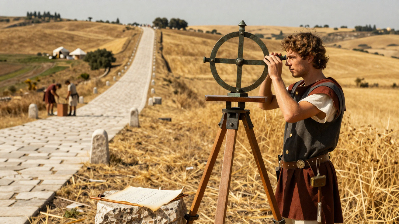
How the Romans built such straight roads remains a question that still fascinates historians and engineers, particularly because many of these routes are still visible today and show a striking level of planning.
How do Roman roads impress with their precision?
The Roman Empire developed one of the largest road networks of the ancient world, linking towns and cities across Europe, North Africa and the Middle East. In many stretches, these roads stand out for running over long distances with virtually no bends.
One of the best-known examples is the Via Appia, stretching more than 500 kilometres between Rome and Brundisium. Other routes, such as Stane Street in England, also highlight the Romans’ ability to hold a line for dozens of kilometres.
Why did the instruments ensure accurate alignments?
When laying out new roads, Roman surveyors relied on dedicated equipment that allowed them to measure distance, level and direction with impressive accuracy, even without modern technology.
The key tools used included:
- Groma, used to set out straight alignments and precise angles.
- Dioptra, which helped with sighting distant points.
- Chorobates, employed to measure levels and differences in elevation across the terrain.
The groma was engineers’ main ally
Experts note that the groma was the most crucial instrument for setting out roads. It consisted of a vertical staff with crossarms and weighted plumb lines that provided clear visual references.
Several surveyors worked together, shifting their positions until they achieved a perfectly aligned line. This approach made it possible to keep a route straight whenever the landscape allowed construction to follow that course.
Did the terrain also influence the route of the roads?
Despite their reputation, not every Roman road was completely straight. Engineers carefully assessed mountains, rivers and other obstacles before choosing the most efficient route.
Where required, slight deviations avoided overly steep climbs, made crossings easier, and linked existing communities-helping journeys become faster and safer.
Did the techniques change from region to region?
The Roman territory encompassed many different peoples, geographic conditions and historical periods. For that reason, specialists argue there was no single method applied uniformly to every project.
Construction brought together soldiers, local labourers, enslaved people and skilled professionals-especially for more complex structures such as bridges. This blend of workforce helped extend a network that today is known to have reached about 300,000 kilometres. See more details about the Roman approach in the video released by the Histórias Romanas channel:
The Roman legacy still inspires engineering
Many roads built nearly two thousand years ago can still be traced, underlining the effectiveness of Roman planning and the quality of the techniques used at the time.
Even with limited technology, the Romans combined measuring instruments, close reading of the landscape and organised labour to create infrastructure that shaped the history of engineering and continues to spark curiosity today.




Comments
No comments yet. Be the first to comment!
Leave a Comment