
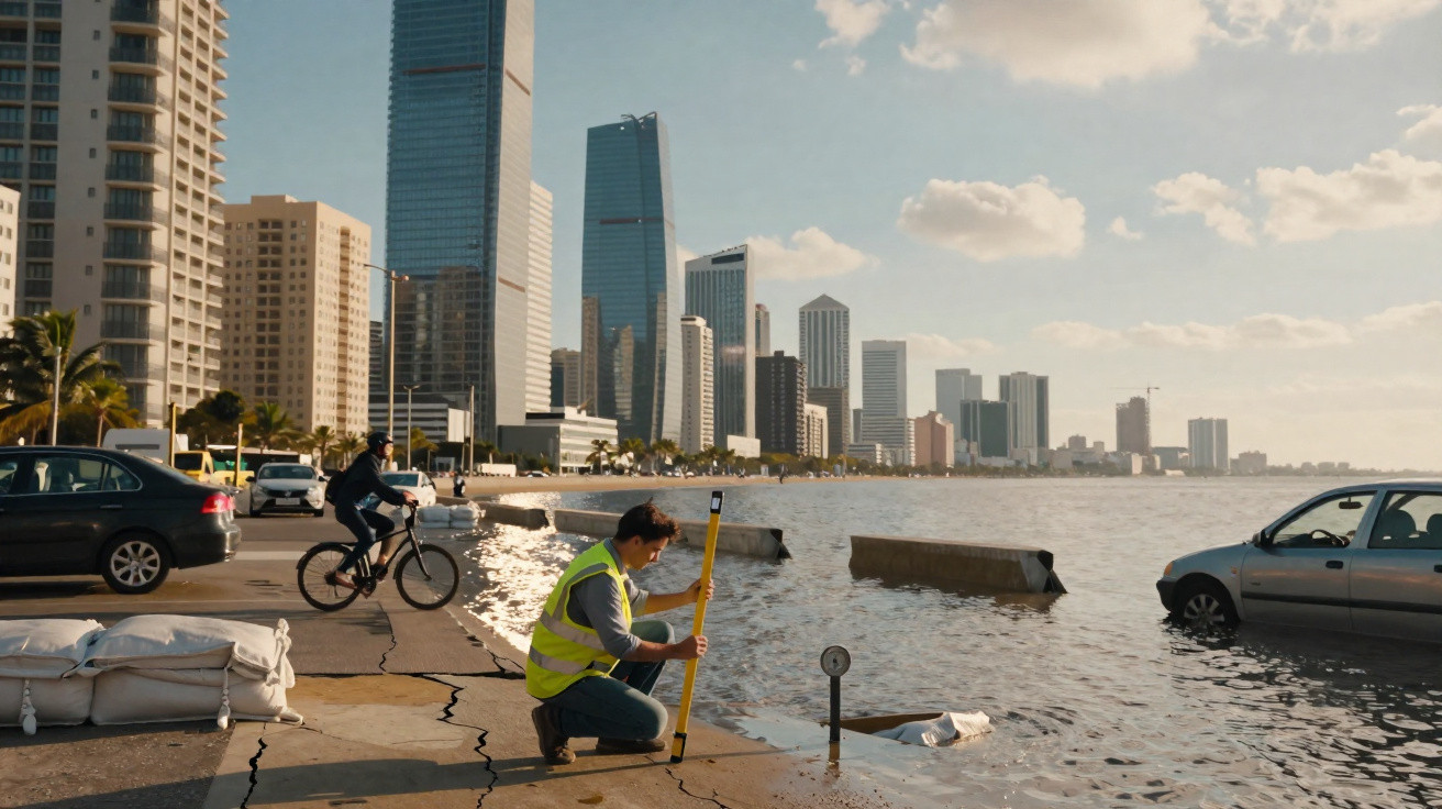
Skyscrapers, gridlocked avenues, neon lights.
Behind the modern skyline, a quiet threat is dragging several megacities down, day after day.
Across different continents, the world’s biggest coastal metropolises are quite literally sinking, millimetre by millimetre. The trend already affects millions of residents, transport networks, water supplies and even the stability of entire countries, in a dangerous pairing with rising sea levels.
What is sinking: far more than a metaphor
Recent research published in the scientific journal Nature Sustainability examined 48 major cities across several continents, all affected by so-called subsidence-the gradual sinking of the ground. Taken together, these areas account for roughly 20% of the world’s urban population.
The figures are stark. In a number of places, the land is dropping faster than the sea is rising, which accelerates the risk of permanent flooding and the loss of territory. In some cities, the process is already considered effectively irreversible within a few decades.
"In many metropolises, the ground sinks by a few centimetres a year, while sea level rises by a few millimetres. Added together, these movements dramatically shorten the time available to respond."
Subsidence: what it actually means
Subsidence is the progressive lowering of the land surface. It can have natural causes, such as tectonic movement or sediment compaction, but today it is growing mainly because of human activity.
The main causes of sinking
- Intensive groundwater extraction: pumping aquifers causes the ground to compact.
- Oil and gas production: emptying deep reservoirs triggers readjustment in rock layers.
- Removal of sand and building materials: destabilises shorelines and the beds of bays and lagoons.
- Unplanned urbanisation: heavy buildings on weak soils speed up compaction.
- Land reclamation of wetlands or mangroves: areas “won from the sea” are often unstable.
When this mix coincides with sea-level rise, every centimetre matters. A waterfront district sinking at 10 mm a year in a region where the ocean rises by 4 mm annually experiences, in practical terms, a 14 mm “gain” in water height relative to the land.
Jakarta, the capital that chose to move away from itself
The most emblematic case highlighted in the study is Jakarta, the capital of Indonesia. Parts of the city sink by around 26 mm/year. In some neighbourhoods, the cumulative drop since the middle of the last century already exceeds several metres.
A large share of this downturn comes from the massive extraction of groundwater. The public water network did not keep up with the metropolis’s growth, and private wells spread without control, draining aquifers.
"Jakarta is sinking so fast that the government decided to move the capital to another island, more than 1,000 kilometres away."
Higher sea walls, extra pumping capacity and retaining barriers are being built, but specialists warn these measures only buy time. Over the long term, entire districts could end up permanently below the tidal line.
Other megacities on the risk list
Jakarta is not an outlier. The study and additional measurements identify several other metropolises sinking at worrying rates.
| City | Country | Estimated maximum sinking | Main drivers |
|---|---|---|---|
| Jakarta | Indonesia | ≈ 26 mm/year | Groundwater pumping, chaotic urbanisation, waterlogged soils |
| Ahmedabad | India | ≈ 23 mm/year | Rapid urbanisation, intensive aquifer use |
| Istanbul | Turkey | ≈ 19 mm/year | Urban expansion, pressure on the subsoil |
| Houston | United States | ≈ 17 mm/year | Oil extraction, groundwater withdrawal |
| Lagos | Nigeria | ≈ 17 mm/year | Sand extraction, port expansion |
| Manila | Philippines | ≈ 17 mm/year | Water pumping, unplanned coastal growth |
Across all of them, the same pattern emerges: intense economic activity paired with weak land-use planning, producing low-lying, densely populated areas squeezed by higher tides and heavier rainfall.
Mexico: sinking far from the sea
Sinking is not confined to coastal cities. Mexico City, built on an ancient lakebed, is subsiding in ways regarded as effectively irreversible in parts of its territory.
Clay-rich soils laid down over thousands of years compact further as groundwater is pumped to supply the metropolis. Historic buildings, underground stations and pipes need constant work to cope with cracks and uneven ground.
"Mexico City shows that the risk isn’t only on the coast: any megacity on fragile ground and overdrawn aquifers can slip into slow collapse."
Even with restrictions on well use, the legacy of decades of extraction leaves a burden that is hard to undo. In some areas, the accumulated drop exceeds ten metres, reshaping natural gradients and making stormwater drainage more difficult.
Europe and France feel the issue on a smaller scale
European cities also record subsidence, though typically at lower rates. Older buildings on soft ground, underground rail tunnels, complex subterranean networks and the natural compaction of urban soils produce slow movements, measured in just a few millimetres a year.
Low-lying coasts-such as parts of the Netherlands, northern Germany and France’s Atlantic seaboard-require continuous monitoring. In some drained agricultural regions, land subsidence combines with sea-level rise, increasing reliance on ever more sophisticated dykes, sluices and pumping systems.
Why the word “inevitable” is appearing more often
When studies suggest the “disappearance” of certain cities may be inevitable, it does not mean an entire metropolis will vanish under water overnight. The reality is more nuanced-and more uncomfortable.
In many situations, whole sections of a city will become so exposed that maintaining them stops making economic sense. The political response often becomes a gradual withdrawal from neighbourhoods, the relocation of strategic functions (such as ports and administrative areas), and the abandonment of places that are densely occupied today.
"Irreversibility refers to the combination of accumulated damage, the extremely high cost of adaptation, and accelerating climate change, which narrows any window for retreat."
Even major engineering schemes-sea walls or enormous pumps-have physical, financial and social limits. And they do not stop subsidence itself: they merely extend the timeline by a few years or decades in the most critical zones.
What can be done to slow the disaster
Adaptation and mitigation measures under discussion
Cities with greater capacity to invest are already debating combined packages of actions:
- Dramatically cut groundwater extraction, expanding surface reservoirs and water reuse.
- Update building regulations to limit very heavy structures on fragile soils.
- Restore mangroves, marshes and wetlands that act as natural buffers against the sea.
- Deploy satellite monitoring systems to measure sinking in near real time.
- Design planned retreat zones, accepting the loss of some areas rather than trying to save everything.
These policies are rarely popular. They collide with the interests of property developers, agribusiness, the construction sector and mineral extraction. Yet the cost of doing nothing is likely to be higher: infrastructure failure, sudden evacuations, housing crises and disputes over safer land.
Understanding the terms to understand the risk
Two concepts recur throughout this debate and are worth defining.
Differential subsidence is when the ground sinks unevenly across different parts of the same city. One district may drop faster than the next, creating steps and slopes that crack roads, rupture pipes and warp structures.
Compound risk is the build-up of threats acting together. In a coastal city, for instance, the danger is not only a higher sea level, but the combination of:
- sinking ground,
- heavier and more frequent rainfall,
- stronger storms,
- urban development that seals the soil,
- ageing drainage systems.
When these drivers stack up, events once labelled a “historic flood” can start happening several times in the same decade, pushing poorer communities into ever more exposed areas.
Scenarios for the coming decades
Climate simulations and subsidence models make it possible to sketch scenarios, albeit with uncertainties. On a pathway of stronger global warming, paired with today’s land-use patterns, some projections suggest that by the end of the century, significant sections of coastal megacities could be chronically inundated.
On a more controlled route-featuring large-scale reductions in groundwater extraction, protection of wetlands and clear limits on building in low-lying zones-the pace of territorial loss slows. But it is unlikely to reach zero. The focus shifts to managing what is unavoidable, rather than preventing it entirely.
"The question stops being whether certain areas will be abandoned, and becomes when, how, and who will have the right to start again on safer ground."
For residents of these cities, the issue can sound distant-almost abstract. Yet cracks in pavements, drains that backflow on ordinary rainy days, and increasingly frequent flooding are already tangible signs that the ground is, quite literally, slipping away.



Comments
No comments yet. Be the first to comment!
Leave a Comment